The Regions of Portugal
Portugal has been divided into a number of regions since its formation as an independent kingdom in 1137.
Historical Regions
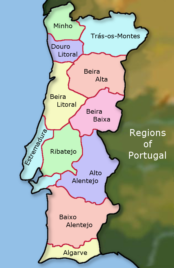
Following the Reconquista in 1249 these historical regions of Portugal were from north to south: Entredouro & Minho, Trás-os-Montes, Beira, Estremadura, Alentejo and Algarve.
In the 1930's when Portugal was controlled by the Salazar regime and the Estado Novo, a division of the country into 11 regions took place. These were: Minho, Douro Litoral, Trás-os-Montes e Alto Douro, Beira Alta, Beira Baixa, Beira Litoral, Estremadura, Ribatejo, Alto Alentejo, Baixo Alentejo and Algarve. These regions were based on the work of geographer Amorim Girão.
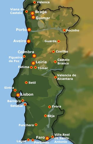
Districts of Portugal (Distritos de Portugal)
Following the 1974 Revolution, Portugal's regions were reclassified again in 1976, this time into 18 districts (first established in 1835) and two autonomous regions: Madeira and The Azores. The establishment of 8 larger administrative regions to replace the 18 districts was rejected in a 1998 referendum.
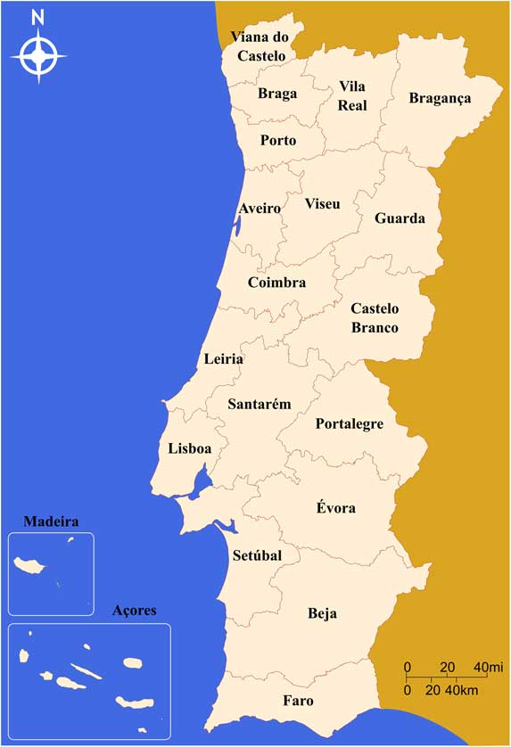
The 18 districts are based on municipalities and are:
- Lisbon
- Leiria
- Santarém
- Setúbal
- Beja
- Faro
- Évora
- Portalegre
- Castelo Branco
- Guarda
- Coimbra
- Aveiro
- Viseu
- Bragança
- Vila Real
- Porto
- Braga
- Viana do Castelo
Each district serves as the area of jurisdiction of a civil governor (Governo Civil), who acts as the local delegate of the Central Government of Portugal.

Autonomous Regions
Madeira and The Azores are classified as autonomous regions of Portugal and are not sub-divided into districts.
Regions for Tourism
In tourist literature and travel guide books Portugal is often divided into classical geographical regions. These are similar to the geographical regions drawn up by Amorim Girão in the 1930's: They often include: Minho, Douro, Trás-os-Montes, Beira Alta, Beira Baixa, Beira Litoral, Estremadura, Ribatejo, Alto Alentejo, Baixo Alentejo (or just Alentejo as a whole) and Algarve.


NUTS Regions of Portugal
NUTS (Nomenclature des unités territoriales statistiques / Nomenclature of Territorial Units for Statistics) is a geocode standard for referencing the subdivisions of countries for statistical purposes within the European Union (EU). It was developed and established by Eurostat.
Portugal has three levels of NUTS.
NUTS 1 comprises continental Portugal and the two autonomous regions of the Azores and Madeira.
NUTS 2 is made up of 5 regions of continental Portugal (Norte Region, Centro Region, Lisboa Region, Alentejo Region, Algarve Region) plus the Azores and Madeira. These regions are in turn sub-divided into smaller sub-regions (NUTS 3, see below).
NUTS 3 consists of 25 sub-divisions (subregiões) of NUTS 2. These are:
Norte
Alto Minho, Cávado, Ave, Área Metropolitana do Porto, Alto Tâmega, Tâmega e Sousa, Douro and Terras de Trás-os-Montes sub-regions of Norte.
Algarve
Algarve
Centro
Oeste, Região de Aveiro, Região de Coimbra, Região de Leiria, Viseu Dão-Lafões, Beira Baixa, Médio Tejo and Beiras e Serra da Estrela all subregions of Centro.
Lisboa Region
Área Metropolitana de Lisboa
Alentejo
Alentejo Litoral, Baixo Alentejo, Lezíria do Tejo, Alto Alentejo, and Alentejo Central.
Região Autónoma dos Açores
Região Autónoma dos Açores
Região Autónoma da Madeira
Região Autónoma da Madeira
Local Administrative Units (LAUs)
In addition there are further sub-divisions into 308 Municipalities or municípios (LAU 1) and 4,260 Civil Parishes (freguesia), known as LAU 2.
Lisbon Municipalities
Lisbon has 18 municipalities. They are Alcochete, Almada, Amadora, Barreiro, Cascais, Lisbon, Loures, Mafra, Moita, Montijo, Odivelas, Oeiras, Palmela, Seixal, Sesimbra, Setúbal, Sintra and Vila Franca de Xira.
Related
Portugal's Geography & Landscape